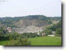
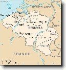
Město: Ghislenghien, Region: Hainaut

Zpět na článek: Belgie (Cestopis)


Navigace mapy Celého Světa online: Kliknutím a tažením na mapě Celého světa, nebo použijte zoom kontrol.

Zeměpisná šířka:

50,6500 (50°38'60.000"N)

Zeměpisná délka:

3,8667 (3°52'0.012"E)

Nadmořská výška:

46 m

Článek: Belgie (Cestopis)

Největší města: Belgie (Cestopis)

Foto, fotky: Belgie (Cestopis)

všechna města: Belgie (Cestopis)

Fórum: Belgie (Cestopis)

Největší města světa

GMT čas: +1 hodin

Posun oproti ČR: 0 hodin

Vzdálenost města Ghislenghien do 25 největších měst státu: Belgie (Cestopis)

Přímá vzdálenostKm
 Ghislenghien - Brussels  39 km
 Ghislenghien - Antwerp  74 km
 Ghislenghien - Gent  46 km
 Ghislenghien - Charleroi  48 km
 Ghislenghien - Liege  120 km
 Ghislenghien - Brugge  77 km
 Ghislenghien - Brugge  29 km
 Ghislenghien - Namur  74 km
 Ghislenghien - Leuven  64 km
 Ghislenghien - Mons  23 km
 Ghislenghien - Alost  34 km
 Ghislenghien - Mechelen  60 km
 Ghislenghien - La Louviere  30 km
 Ghislenghien - Kortrijk  47 km
 Ghislenghien - Hasselt  108 km
 Ghislenghien - Ostend  92 km
 Ghislenghien - Sint-niklaas  60 km
 Ghislenghien - Doornik  35 km
 Ghislenghien - Tournai  35 km
 Ghislenghien - Genk  120 km
 Ghislenghien - Seraing  114 km
 Ghislenghien - Roeselare  61 km
 Ghislenghien - Verviers  141 km
 Ghislenghien - Mouscron  47 km
 Ghislenghien - Beveren  69 km

Vzdálenost města: Ghislenghien do Top 10 měst světa

Přímá vzdálenostKm
 Ghislenghien - Praha  754 km
 Ghislenghien - Berlín  690 km
 Ghislenghien - Londýn  294 km
 Ghislenghien - Los Angeles  9 027 km
 Ghislenghien - Moskva  2 294 km
 Ghislenghien - New York  5 867 km
 Ghislenghien - Paříž  227 km
 Ghislenghien - Peking  8 001 km
 Ghislenghien - Rio De Janeiro  9 393 km
 Ghislenghien - Sydney  16 791 km
 Ghislenghien - Tokio  9 491 km


Navigace: A B C Č D E F G H I J K L M N O P Q R Ř S Š T U V W X Y Z Ž VŠE

Podpořte nás · Kontakt· Kniha návštěv · RoboStav
Copyright (c) 2024 by CELÝSVĚT. Všechna práva vyhrazena!
Kontaktní e-mail: celysvet(zav)email.cz


Ghislenghien
Ghislenghien


Ghislenghien
Ghislenghien


Ghislenghien
Ghislenghien


Ghislenghien
Ghislenghien


Ghislenghien
Ghislenghien


Fotogalerie ()...


Přidat foto...


Poradna
Poradna
Poslední dotazy:
HELP !


IQ test online

Hry online
Svátek má  Brigita, zítra Sabina